Lot
3748
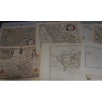
Lot 3748
Cartography - a large and miscellaneous collection of early ...


Hammer
£60
Cartography - a large and miscellaneous collection of early 19th century and later maps, comprising GB and regions, European countries and states, Continents, and World, etc., including Australia, Tasmania, John Crane Dower (1791-1847), Van Dieman's Land, London: [n.d., c. 1830], engraving, 28.5cm x 23.5cm, (1); Joseph Wilson Lowry, FRGS (1803–1879), The United States, of North America, Glasgow: Blackie & Son, [n.d., 19th century], two-fold, engraving with some hand-coloured delineation, 39cm x 52.5cm, (1); India, Joshua Archer (1792-1863), Diocese of Bombay, London: November 1842, engraving, 31.5cm x 25cm, (1); domestic British diocesan maps, various, larger folding maps; Royal Navy, Sea Chart, Norway, South Coast, Sheet 1: The Naze to Kristiansand, London: The Admiralty, June 1917, 69cm x 107cm, (1); Prussia, three-fold, 18th/19th century engraving, hand-coloured delineation, 27cm x 44cm, (1); etc., some late 18th century maps (but the minority), various media and sizes, some loosely-inserted in an album, otherwise loose, [qty]
Fees apply to the hammer price:
Room and Absentee Bids:
29.70% inc VAT*
Online and Autobids:
29.7% inc VAT*
Please see the auctioneers terms & conditions for more information