Lot
5703
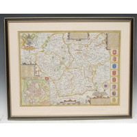
Lot 5703
Cartography - The Times Contour Road Map of England and Wale...


Hammer
£35
Cartography - The Times Contour Road Map of England and Wales in 10 Sheets, on the Scale of 3 Miles to 1 Inch/Each Sheet Measuring 31" x 40", London: [n.d.], printed in colour, canvas laid, red cloth box en suite; Ministry of Transport Road Map of England & Wales, ex-lib and in their cloth box; New Chart of North & Central England, [n.d., early 20th century], printed in colour, cloth covers; Plan of Nottingham, red cloth covers; Philips' Atlas for Beginners, late 19th/early 20th century; after Robert Morden (c. 1650 – 1703), two-page map of Derbyshire, 18th century strike, hand-coloured engraving; early 18th century and later road maps; others; etc
Fees apply to the hammer price:
Room and Absentee Bids:
25.20% inc VAT*
Online and Autobids:
28.8% inc VAT*
Please see the auctioneers terms & conditions for more information